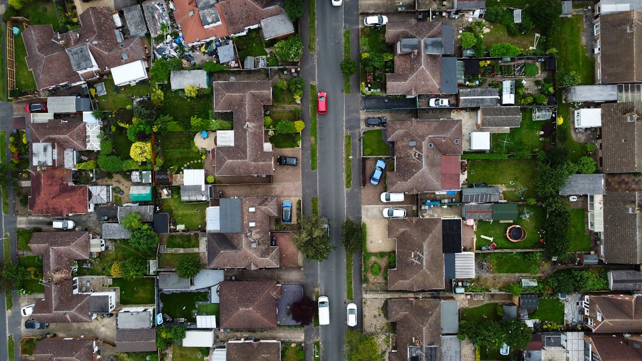
Raw capture only
Professional aerial capture. No editing.
- Imagery delivered unedited
- No retouching or sky replacement
- No colour grading, music or captions
- No finished marketing reel included
CAA-licensed drone services in Liverpool and the North West. Aerial imagery and video for property, land and commercial sites, with prices from £150.
Professional aerial capture. No editing.
Flights depend on conditions and permissions.
Pricing built for local work.
For estate agents, landlords and standard residential property listings that need clean aerial context.
For listings that need both aerial stills and short video clips for reels, websites or in-house editing.
For larger homes, rural properties, waterfront homes, land plots, large gardens or properties needing wider context.
For commercial agents, warehouses, yards, development plots, venues, farms, schools and business premises.
Every booking is reviewed for airspace, weather and site suitability before any flight is scheduled. If a flight cannot be authorised, we will say so before any payment is taken.
Property research has consistently linked aerial imagery on listings with faster sales and significantly higher online engagement than ground-only photos. NAR and MLS data has reported homes with drone photography selling materially faster than comparable listings without it. The gap varies by price bracket, property type and platform, but the direction has been consistent.
Cazimi covers Liverpool and the wider Merseyside and North West region for residential, commercial and land drone services. The areas below are flown at standard local pricing. Anything further afield is still possible, with a small travel uplift quoted upfront.
Not seeing your area? Send the postcode and we will confirm coverage and any travel uplift before booking.
Cazimi drone services in Liverpool start from £150 for residential aerial property images and £195 for images plus short video clips. Larger or rural properties start from £245, and commercial sites from £350. Every price on this page is fixed where possible, with quotes only where site size or complexity makes that fairer. Commercial pricing excludes VAT, as we are not currently required to register.
Yes. Cazimi flies under a current CAA Flyer ID and A1/A3 Open Sub Category certification, with a 120m (400ft) height limit. Documentation can be supplied on request before any flight.
Liverpool city and all surrounding districts are covered as standard, including Wirral, Sefton, Crosby, Formby, Maghull, Ormskirk, Southport, St Helens, Widnes, Runcorn, Warrington and Chester. Sites further afield in the North West are still possible with a small travel uplift.
Local Liverpool jobs are usually flown within a few working days of booking and delivered within 24 to 48 hours of the flight, weather and airspace permitting. Time-sensitive sales-day capture can sometimes be accommodated, please ask.
No. The pricing on this page is for professional raw capture only. That suits estate agencies, marketing teams and property businesses who already have an editor or in-house workflow.
Many central Liverpool postcodes sit inside controlled airspace around Liverpool John Lennon Airport. We assess airspace, weather and ground risk for every site before booking, and only fly when permission and conditions allow. If a flight cannot be authorised, we will say so before any payment is taken.
Industry data from NAR and MLS in the US, supported by UK portal experience, has consistently linked aerial imagery on listings with faster sales and significantly higher engagement than ground-only photographs. The size of the gap varies by price bracket, property type and platform.
Yes. Commercial site capture starts from £350 (excludes VAT, as we are not currently required to register) and includes oblique, top-down and boundary imagery for warehouses, yards, development plots, venues, farms, schools and business premises across Liverpool and the North West.
If you need vulnerability analysis, site mapping, 3D modelling, CCTV blind-spot assessment, intervisibility, time-distance analysis or a full threat and vulnerability report, we can help with that too.